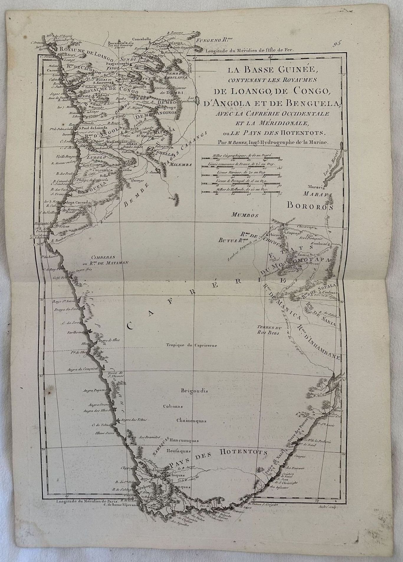
LA BASSE GUINEE CONTENANT LES ROYAUMES DE LOANGO, DE CONGO, D'ANGOLA ET DE BENGUELA AVEC LA CAFRERIE OCCIDENTALE ET LA MERIDIONALE OU LES PAYS DES HOTENTOTS
LA BASSE GUINEE CONTENANT LES ROYAUMES DE LOANGO, DE CONGO, D'ANGOLA ET DE BENGUELA AVEC LA CAFRERIE OCCIDENTALE ET LA MERIDIONALE OU LES PAYS DES HOTENTOTS | Libri antichi e moderni | Brion De La Tour (1743-1803)
Metodi di Pagamento
- PayPal
- Carta di Credito
- Bonifico Bancario
- Pubblica amministrazione
- Carta del Docente
Dettagli
- Autore
- Brion De La Tour (1743-1803)
Descrizione
Mappa dettagliata del 1760 circa del geografo francese Brion de la Tour che mostra la costa meridionale dell'Africa dal Congo al Sud Africa. La mappa contine numerosi dettagli e annotazioni riguardanti recenti esplorazioni. Autore: Brion de La Tour (1743-1803) Data: 1760 circa Tecnica: incisione su rame Dimensione foglio: 29x41,5 cm Dimensione dell'incisione: 23,5x38 cm Condizioni: buone. Piegatura verticaleVery beautiful detailed map of 1760 circa by the French geographer Brion de la Tour featuring the south coast of Africa from Congo to South Africa. The map is filled with details and notations concerning recent explorations. Author: Brion de La Tour (1743-1803) Date: 1760 circa Technique: etching on copper Leaf Dimension: 29x41,5 cm Engraving Dimension: 23,5x38 cm Conditions: Very good conditions. Vertical foldings.
